University of Georgia

Evaristo Critical Zone Hydrology Lab

At the intersection of isotope geochemistry and hydrogeology, we use environmental tracers to test what groundwater models assume — how aquifers connect, how long water is stored, and where it goes underground.

Isotope Geochemistry Hydrogeology Water Resources Critical Zone Science
37
Publications
4
Lab Members
5
Courses
4
Research Themes

Latest Publications

Recent peer-reviewed work from the lab

View all 37 publications →

Research Themes

Theme 01

Hydrogeology & Wetland-Aquifer Connectivity

The systems we model as sealed are quietly talking to each other.

Theme 02

Water Ages & Transit-Time Distributions

Every drop leaving a catchment carries a memory of when it arrived.

Theme 03

Critical Zone Architecture & Deep Storage

The subsurface refuses to mix.

Theme 04

Isotope & Geochemical Tracers: Deep Subsurface to Deep Time

The same fingerprints that date a raindrop can reconstruct an ancient climate.

Lab Members

Evaristo Critical Zone Hydrology Lab

Jaivime Evaristo
Principal Investigator

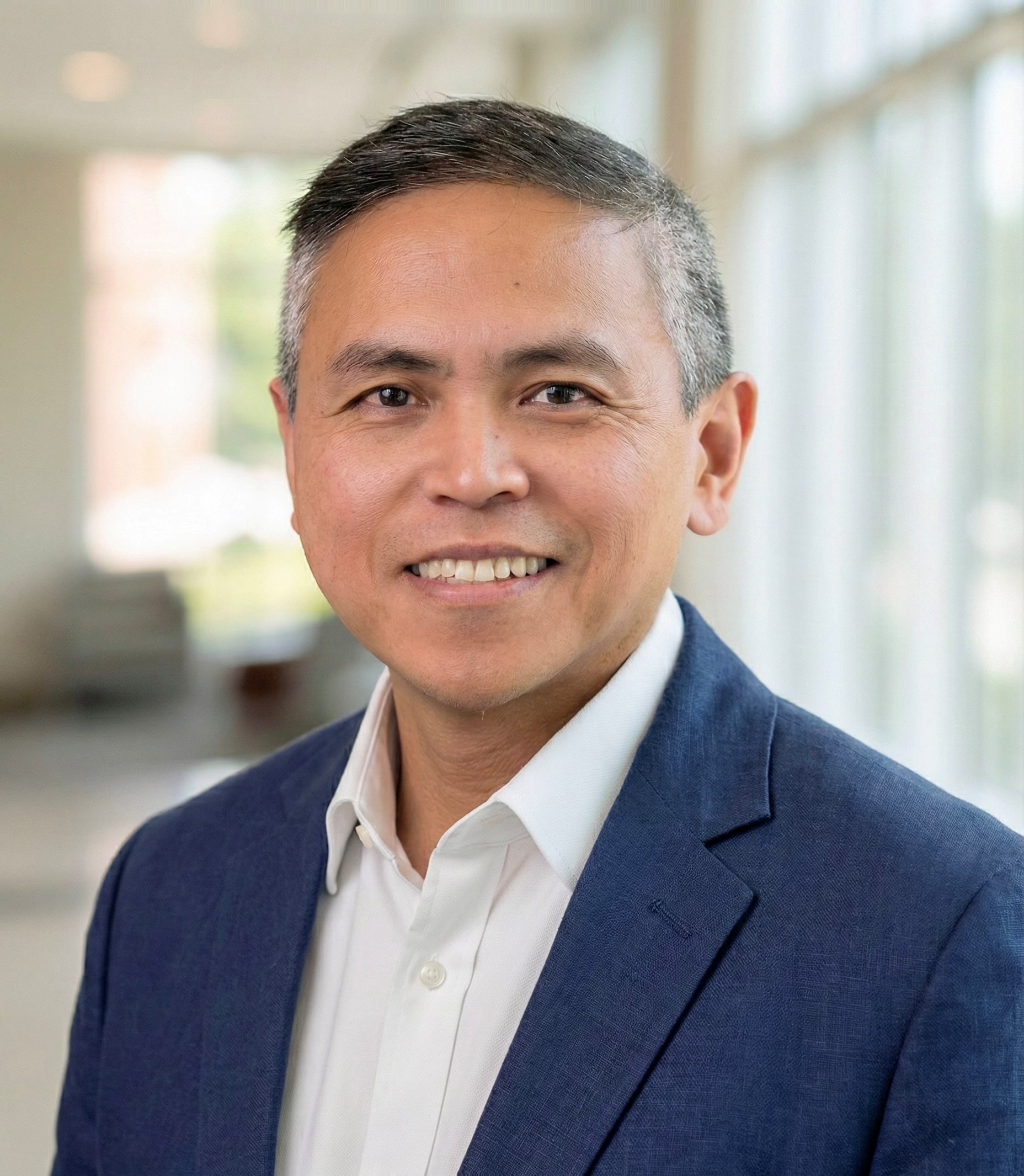
Jaivime Evaristo, Ph.D., P.H.

Jaivime is an Assistant Professor at the University of Georgia. A full-blooded Filipino geoscientist and US permanent resident (green card holder) with a non-traditional career path, he earned an undergraduate degree in Cell Biology from the University of the Philippines before spending a decade in industry and management consulting. He later pursued an MS in Geosciences (hydrogeology concentration) at the University of Pennsylvania, followed by a PhD at the Global Institute for Water Security, University of Saskatchewan. From 2019 to 2024, he was a tenured Assistant Professor at Utrecht University.

His research focuses on the critical zone and uses tools in hydrology, water resources, and isotope geochemistry to characterize the influence of natural and anthropogenic processes on matter and energy exchange across the hydrosphere, geosphere, and atmosphere.

Outside of work, he loves spending time with his wife and two kids!

Maria Jessica Gabriel
PhD Student (expected 2029)

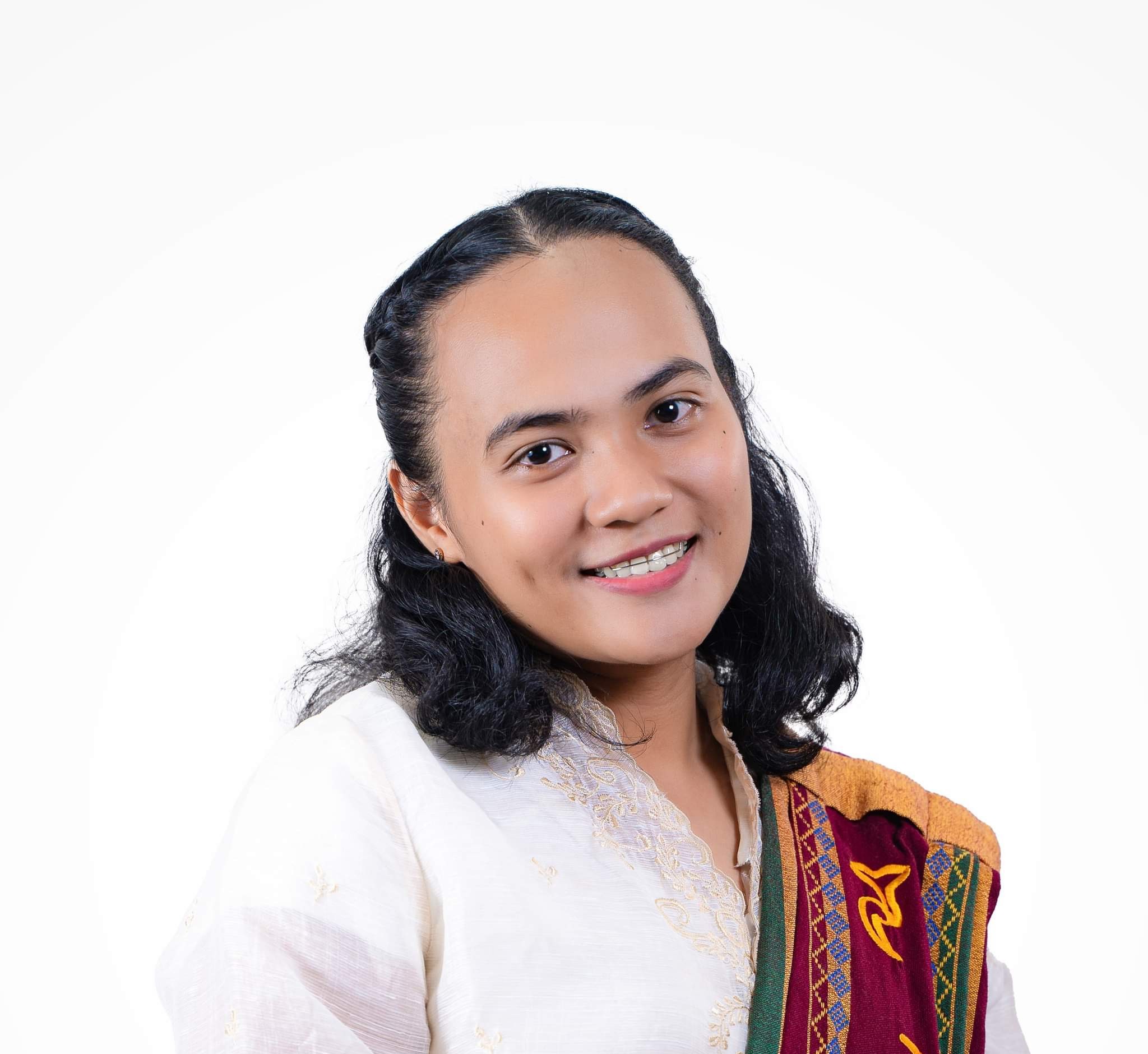
Maria Jessica Gabriel, M.S.

Jessica is a PhD student at the University of Georgia and an assistant professor at the University of the Philippines Los Baños. She finished an Erasmus Mundus Joint Masters Program in Sustainable Tropical Forestry (SUTROFOR) at Bangor University, UK and the University of Copenhagen, Denmark. She is particularly interested in how land use affects water quantity and quality.

Funding: U.S. Forest Service

Audra Werley
MS Student (expected 2027)

Audra Werley

Audra is a recent graduate of the College of Coastal Georgia with a BS in Environmental Science. She has experience as an environmental consultant and is passionate about wetland conservation and management. She is interested in surface and groundwater interaction using environmental tracers and numerical modeling.

Funding: The Chemours Company; U.S. Geological Survey

Maxton Moreland
Summer 2026 Hydrology & Water Resources Intern

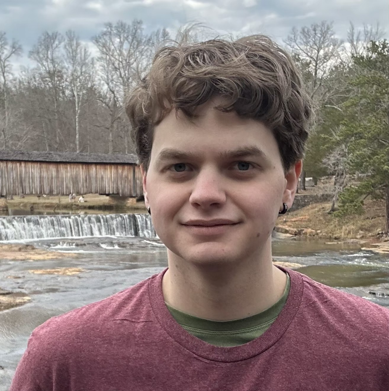
Maxton Moreland

Maxton joins the lab as Summer 2026 Hydrology and Water Resources Intern. He is interested in understanding how natural disasters impact the stability of forest and coastal ecosystems. Maxton is a prospective 2028 graduate of the University of Georgia with a degree in Natural Resource Management and Sustainability with a concentration in Water and Soil Resources.

Research

Testing what groundwater models assume, at the intersection of isotope geochemistry and hydrogeology

Hydrogeology & Wetland-Aquifer Connectivity

Hydrogeologists draw confining units as solid lines on a cross-section — an assumption inherited, not a quantity measured. Tracers say otherwise. At the Okefenokee Swamp, isotopes and hydraulic head show the Hawthorn Formation leaks, upending the regional conceptual model and the water budget built on it. Across Okefenokee, Coweeta, and Sapelo Island, the question is how many other "confined" systems are confined only on paper.

Anchor: Evaristo, Jackson & Rasmussen (2025), "Not so isolated: vertical connectivity between the Okefenokee Swamp and Floridan Aquifer," Environ. Res.: Water. DOI: 10.1088/3033-4942/ae2653

Water Ages & Transit-Time Distributions

Storage is not a bucket waiting to be emptied. It is age-structured, and that structure — not the volume — governs how a catchment buffers, delays, and releases water and everything it carries. StorAge Selection functions and transit-time distributions make that hidden structure legible, turning "how much water" into "how old." Our TTD Toolkit puts those methods in anyone's hands.

Anchor: Evaristo, Wright, Bauser, Knighton, Johnson & Kim, "Tracer Labeling and Transit Time Modeling in Soil-Plant Systems," Ecohydrology. DOI: 10.1002/eco.70182
Software: TTD Toolkit. Zenodo: 10.5281/zenodo.18318447

Critical Zone Architecture & Deep Storage

We model the subsurface as a reservoir that blends whatever enters it. It does not. Water sits in compartments — pore-scale, depth-structured — that exchange so reluctantly a catchment can hold water for years to decades. The critical zone reaches well below its weathered skin, into fractured saprolite and bedrock no shovel can reach, so geophysics and depth-resolved tracers stand in for excavation. How much of a catchment's memory hides in rock nobody has sampled?

Representative work: Huang, Evaristo & Li, "The nature and extent of bomb tritium remaining in vadose zones," Vadose Zone J. DOI: 10.1002/vzj2.20304; Evaristo et al., "Characterizing fluxes and age distribution of soil water, plant water, and deep percolation," WRR 55, 3307–3327. DOI: 10.1029/2018WR023265 Early evidence of subsurface compartmentalization: Evaristo, Jasechko & McDonnell (2015), Nature 525, 91–94. Link

Isotope & Geochemical Tracers: Deep Subsurface to Deep Time

A tracer is not a topic; it is a method that ignores scale. The same isotopic and geochemical fingerprints that pin down a nitrate source, map submarine groundwater discharge, or follow a contaminant through an urban stream also read lithium from oil-field brines and temperature from ancient clays. One measurement principle stretches from a contaminant plume to a Paleogene summer.

Anchors: Ibarra & Evaristo (2024), clay mineral paleothermometry, Commun. Earth Environ. Link; Blake et al., Evaristo & Ibarra, Li-enriched oil field brines, Appl. Geochem. DOI: 10.1016/j.apgeochem.2026.106973
Also: nitrate source tracing (Matiatos et al. 2023); submarine groundwater discharge (Cardenas et al. 2020, GRL); mangrove & urban streams (Taillardat et al. 2019; Ramchunder et al. 2022)

Publications

Peer-reviewed (* = equal contributions / co-lead / co-corresponding)

2026
37.
Blake, M.R., et al., Evaristo, J., Ibarra, D.E. "Investigating reservoir-scale heterogeneity in Li-enriched oil field brines of the Devonian Leduc and Nisku formations, Alberta Basin, Canada". Appl. Geochem. 106973 DOI: 10.1016/j.apgeochem.2026.106973
36.
Sidle, R.C., Ziegler, A.D., Mosquera, G.M., Evaristo, J., Farrick, K.K., Isaev, E. "Transdisciplinary catchment management in the developing tropics: bridging scientific enquiry with societal needs". Hydrol. Sci. J. DOI: 10.1080/02626667.2026.2647891
35.
Evaristo, J. "Left High and Dry: Deep Soil Water Depletion and Ecohydrological Resilience on China's Loess Plateau". WIREs Water. DOI: 10.1002/wat2.70053 Open Access
34.
Evaristo, J., Wright, C.W., Bauser, H., Knighton, J.K., Johnson, D., Kim, M. "Tracer Labeling and Transit Time Modeling in Soil-Plant Systems…" Ecohydrology. DOI: 10.1002/eco.70182 Open Access
2025
33.
Evaristo, J., Jackson, C.R., Rasmussen, T.C. "Not so isolated: isotopic and hydraulic evidence of vertical connectivity between the Okefenokee Swamp and Floridan Aquifer." Environ. Res.: Water. DOI: 10.1088/3033-4942/ae2653 Open Access
2024
32.
Huang, Y., *Evaristo, J., *Li, Z., et al. "The nature and extent of bomb tritium remaining in vadose zones: a synthesis and prognosis". Vadose Zone J. DOI: 10.1002/vzj2.20304 Open Access
31.
*Ibarra, D.E., *Evaristo, J. "Soil pore water evaporation and temperature influences on clay mineral paleothermometry". Commun. Earth Environ. Link Open Access
30.
Zhao, Y., et al., *Evaristo, J. "Dynamic hydrological niches: how plants compete for water in a seasonally-dry ecosystem". J. Hydrol. DOI: 10.1016/j.jhydrol.2024.130677
29.
Shipley, O.N. … Evaristo, J. … "IsoBank: a centralized repository for isotopic data". PLOS ONE 19(9) DOI: 10.1371/journal.pone.0295662
2023
28.
Evaristo, J., et al. "Water woes: institutional challenges in achieving SDG 6". Sustain. Earth Rev. 6, 13 DOI: 10.1186/s42055-023-00067-2 Open Access
27.
Matiatos, I., et al., Evaristo, J., et al. "Nitrate isotopes in catchment hydrology…" J. Hydrol. DOI: 10.1016/j.jhydrol.2023.130326
26.
Tao, Z., *Evaristo, J., et al. "Tritium and trees: bomb peak perspective on soil water dynamics…" Catena 232 DOI: 10.1016/j.catena.2023.107474 Open Access
2022
25.
Ramchunder, S.J., et al., Evaristo, J., et al. "Flowpath influence on stream acid events in tropical urban streams". Hydrol. Process. 36(1) DOI: 10.1002/hyp.14467
2021
24.
*Knighton, J., et al., *Evaristo, J., et al. "Phylogenetic Underpinning of Groundwater Use by Trees". GRL 48 DOI: 10.1029/2021GL093858 Open Access
23.
Evaristo, J., Jameel, Y., Chun, K.P. "Implication of stem water cryogenic extraction…" PNAS DOI: 10.1073/pnas.2100365118 Open Access
22.
Shi, P., et al., Evaristo, J., Li, Z. "Impacts of deep-rooted fruit trees on deep soil water recharge…" Agric. For. Meteorol. DOI: S0168192321000083
21.
Zhao, Y., et al., Evaristo, J., Wassen, M. "Contrasting adaptive strategies in a semiarid revegetated ecosystem". Agric. For. Meteorol. DOI: S016819232100006X
2020
20.
Xiang, W., Evaristo, J., Li, Z. "Recharge mechanisms of deep soil water revealed by water isotopes…" Geoderma 369 DOI: S0016706119324498
19.
Knighton, J., Singh, K., Evaristo, J. "Understanding Catchment-Scale Forest Root Water Uptake…" GRL DOI: 10.1029/2019GL085937 Open Access
18.
Cardenas, M.B., et al., Evaristo, J. "Submarine groundwater and vent discharge…" GRL DOI: 10.1029/2019GL085730 Open Access
2019 & Earlier
17.
Zhi, L., Evaristo, J., et al. "Spatiotemporal variations in hydrochemical characteristics…" Environ. Pollut. 254 DOI: S0269749119316677
16.
Evaristo, J., et al. "Characterizing fluxes and age distribution of soil water, plant water, and deep percolation…" WRR 55, 3307–3327 DOI: 10.1029/2018WR023265 Open Access
15.
Taillardat, P., et al., Evaristo, J. "Assessing nutrient dynamics in mangrove porewater…" Mar. Chem. 214 DOI: S0304420319300489
14.
Huang, Y., Evaristo, J., Li, Z. "Multiple tracers reveal different groundwater recharge mechanisms…" Geoderma 353 DOI: S0016706119300783
12.
McDonnell, J.J., Evaristo, J. +14 co-authors. "Water sustainability and watershed storage". Nat. Sustain. 1, 378 (2018) Link
7.
Evaristo, J. & McDonnell, J.J. "Prevalence and magnitude of groundwater use by vegetation: a global stable isotope meta-analysis". Sci. Rep. 7, 44110 (2017) Link Open Access
3.
Evaristo, J., Jasechko, S., McDonnell, J.J. "Isotopic composition of plant water sources". Nature 536, E3 (2016) Link
1.
Evaristo, J., Jasechko, S., McDonnell, J.J. "Global separation of plant transpiration from groundwater and streamflow". Nature 525, 91-94 (2015) Link

Teaching

University of Georgia

WASR 4500/6500

Quantitative Methods in Hydrology

3 creditsSenior & GraduateFall semester

Advanced analysis of hydrologic processes — precipitation, evapotranspiration, streamflow, groundwater occurrence and movement, and soil zone flow and transport. Emphasis on quantitative methods with field and laboratory data.

WASR 6200

Rates and Dates: Hydrological Methods and Applications

3 creditsSenior & GraduateFall semester

Explore how scientists use environmental tracers — like isotopes and chemistry — to unravel the movement of water above and belowground, track pollution, and date water and contaminant sources using cutting-edge tools and data science.

WASR 8200

Hillslope Hydrology

3 creditsGraduate onlySpring semester

Intensive, literature-driven and field-based exploration of hillslope hydrology. Students complete a journal-style critical review and collaborative field project synthesizing course concepts.

CRSS/FANR 3060

Soils and Hydrology

3 creditsJuniorSpring semester

Soil formation and morphology, physical and chemical properties, soil-water interactions, hydrologic processes, and water quality. Co-taught with Matt Levi (Soils).

FYOS 1001

Fingerprinting Your Water and Stuff!

1 creditFreshmanFall & Spring

Hands-on introduction to stable and radioactive isotopes as natural "fingerprints" that trace the origins of water and other materials. First-Year Odyssey Seminar.

Service

Professional and institutional service

Editorial Roles

Grant Review

  • Panels: US National Science Foundation; Dutch Research Council (NWO)
  • Ad hoc: Swiss NSF; US NSF; Leverhulme Trust (UK); ANID (Chile); NParks Singapore

Peer Review

  • Nature · Nature Geoscience · Nature Water · Science · Water Resources Research · Geophysical Research Letters · Journal of Hydrology · Hydrological Processes · WIREs Water · Ecohydrology · Environmental Research Letters · Scientific Reports · New Phytologist · and 20+ additional journals

Institutional

  • Graduate Program Faculty (Sep 2024–), Graduate Council, University of Georgia
  • Advisory Board (Jan 2022–), GradMAP Philippines
  • Staff Representative, Faculty Council, Utrecht University (2023–24)
  • Education Committee, Water Science & Management MSc, Utrecht University (2021–24)

Submit Samples

Stable isotope analysis services for water and other liquid samples

Picarro L2140-i Cavity Ring-Down Spectrometer

Our Picarro L2140-i consistently outperforms factory specifications, achieving δ18O and δD precision approximately three times better than the manufacturer's guaranteed values. The instrument supports high-throughput, high-precision analysis of water isotopes for hydrology, ecology, and water resources applications.

Sample Analysis Pricing

Per-sample rates by isotope analysis, sample type, volume tier, and UGA affiliation.

Isotope analysis Sample type UGA rate / sample Outside UGA rate / sample
1–200 samples 200+ samples 1–200 samples 200+ samples
2H, 18OWater$8.82$8.82$9.41$8.82
2H, 18O, 17OWater$10.29$10.29$10.98$10.29
2H, 18OOther liquids*$26.45$26.45$28.23$26.45
2H, 18O, 17OOther liquids*$30.86$30.86$32.94$30.86

*Other liquids = liquids with high total dissolved solids (e.g., plant leaves, stems, juices). Note: Analysis of brackish or brine samples may incur higher rates due to greater consumption of consumables (syringes, septa, salt liners). Please contact us for a custom quote on non-standard sample types.

Get in Touch Before Sending Samples

Please contact Dr. Evaristo for detailed information prior to sample collection and before sending your samples to our lab. This ensures we can advise on appropriate sampling protocols, container types, shipment logistics, and turnaround times for your specific project.

Email: evaristo@uga.edu
Address: University of Georgia, Athens, GA 30602, USA

Explore Your Data in Dual-Isotope Space

Upload a results spreadsheet to visualize your samples on a map and in δ²H–δ¹⁸O space against the Global Meteoric Water Line — with descriptive statistics, d-excess, and an optional Local Meteoric Water Line. Everything runs in your browser; no data is uploaded anywhere.

Open in a new tab →

Georgia Streamflow Explorer

Interactive daily discharge records for every USGS gaging station in Georgia

Every Georgia Gage, 1883 to Present

Explore daily streamflow from more than 600 U.S. Geological Survey gaging stations across Georgia and the Georgia–Florida border strip — including the shared border rivers (St Marys, Suwannee, Apalachicola) whose gages USGS files under Florida — more than 5.4 million daily discharge values spanning 1883 to the present. Search or map-select a station, zoom through its full period of record, and examine seasonal flow regimes, flow duration curves, and annual water-year trends. The dataset refreshes automatically every morning from the USGS National Water Information System, so the record shown is always current. Any station’s records can be downloaded as CSV directly from the explorer — or grab the complete nightly-refreshed archive.

Open in a new tab →

Georgia Groundwater Explorer

Interactive daily water-level records for every USGS recorder well in Georgia

Every Well, 1900 to Present

Explore groundwater levels from nearly 3,000 U.S. Geological Survey wells across Georgia: 409 continuous recorder wells (2.6 million daily readings back to 1942) plus 2,536 periodic wells measured by field visits (315,000 measurements back to 1900), from the surficial aquifers of the coast to the Upper Floridan and the Piedmont crystalline rocks. Every well is labeled by type — recorder or periodic — with a type filter, and wells with fewer than three usable measurements are left out of the viewer. Search or map-select a well, zoom through its full record, and examine seasonal patterns, level duration curves, annual means, and water-table trends. The dataset refreshes automatically every morning from the USGS National Water Information System. Any station’s records can be downloaded as CSV directly from the explorer — or grab the complete nightly-refreshed archive.

Open in a new tab →

California Groundwater Explorer

Interactive daily water-level records for every USGS recorder well in California

Every Well, 1900 to Present

Explore groundwater levels from nearly 13,000 U.S. Geological Survey wells across California: 486 continuous recorder wells (10 million daily readings across depth and elevation series) plus 12,369 periodic wells measured by field visits (2.3 million measurements back to 1900), from the Coastal Basin aquifers to the Central Valley and the Basin and Range. Every well is labeled by type — recorder or periodic — with a type filter, and wells with fewer than three usable measurements are left out of the viewer. Many recorder wells report both depth to water and water-surface elevation; switch between series, overlay field measurements, and examine seasonal patterns, level duration curves, annual means, and water-table trends. The dataset refreshes automatically every morning from the USGS National Water Information System. Any station’s records can be downloaded as CSV directly from the explorer — or grab the complete nightly-refreshed archive.

Open in a new tab →

Utrecht University

2019 – 2024 · Tenured Assistant Professor

From 2019 to 2024, I was a tenured Assistant Professor at Utrecht University in the Netherlands. This page archives my teaching and graduate supervision from that period.

GEO4-6009

Sustainable Water Resources Management

7.5 ECTSMasterMain Instructor

Fundamental understanding of catchment functions (partition, storage, release) and hydrological processes in natural and built environments. Students explore sustainable strategies for water resources management using critical thinking, quantitative skills, and management methodologies.

GEO4-6008

Research in Water Science and Management

7.5 ECTSMasterMain Instructor

Considerations, methods, and research best practices in water science and management. Prepares future water sector professionals to formulate and implement reasonable courses of action for complex water issues. Partly prepares students for their master thesis.

GEO2-2131

Ecohydrology

7.5 ECTSBachelorCo-instructor

Scientific analysis of the processes governing the interaction between biota and the hydrological cycle. Practical application through computer modeling of ecohydrological systems at different scales.

GEO1-2412

Natural Processes

7.5 ECTSBachelorCo-instructor

Earth's energy balance, the hydrological cycle, and the elemental cycles of carbon, nitrogen and phosphorus. Major stocks of energy, water, and elements across the atmosphere, hydrosphere, lithosphere, and biosphere.

Total theses supervised at Utrecht: 11 Masters and 9 Bachelors.

Master's Theses

  • Joren van Os (2023) — Using flexible power in Dutch water pumping stations to balance the energy system
  • Roos Peeters (2022) Cum LaudeSocial Cost-Benefit Analysis of Mangrove Restoration in Mozambique. Thesis. Now Community Engagement Officer at Van Oord.
  • Peter Beemster (2022) — The SLAMDAM mobile flood barrier as an adaptive measure for building climate resilience against flooding in Sub-Saharan Africa
  • Daniel Peregrina Gonzalez (2022) — Model-based urban drought hazard assessment using global open data. Thesis
  • Alice Ampolini (2022) — Inclusion of resilience and flood protection measures to the Urban Climate Risk Index (UCRI). Now Assistant Project Manager at BT Geoconsult.
  • Jasper van Lieshout (2021) — Modelling alternative drinking water extraction strategies for the sandy Pleistocene regions of the Netherlands. Thesis. Now at Nelen & Schuurmans.
  • Nathalie van Tricht (2021) — A pro-active regional control system framework for the polder "De Eendragt" in the Netherlands. Thesis
  • Joey Ewals (2020) — Modelling the effects of the Maaswerken on the drinking water production near Roosteren. Thesis. Now Hydrologist at Waterschap Limburg.
  • Maureen van Rijn (2020) — Rainproof urban water management in the municipality of Heemskerk. Now Strategy Trainee at Dunea Drinking Water.
  • Adam Noctor (2020, MSc Sustainable Development) — Identifying the sources of nitrate in surface and ground waters using stable isotopes: A global overview. Thesis
  • Theresa O'Halloran* (2018, University of Nevada Reno) — Impacts of forest management on hydrologic processes. Thesis. *Committee Member.

Honors Students

  • Michele Joie Prawiromaruto (MSc Sustainable Development) — Aggregate Confusion of ESG Ratings in the Water Sector. Funded by Bright Minds Assistantships (Apr–Nov 2023).
  • Mira van Meteren (BSc Global Sustainability Science) — Sights and Sounds of the Unseen: An Audio-Visual Project on Submarine Groundwater Discharge